MultispectralImaging
Sustainable Approach with Advanced Drone Technologies
Thousands of farmers, agricultural professionals, environmental researchers and forestry experts worldwide have already experienced the advantages of drones integrated with multispectral sensors. FIXAR integrated UAV platforms simplify the work, increase efficiency, and protect assets, people, and the environment. Professional drone with multispectral camera is a sustainable and cost-effective management solution supporting clever data-driven decision-making.
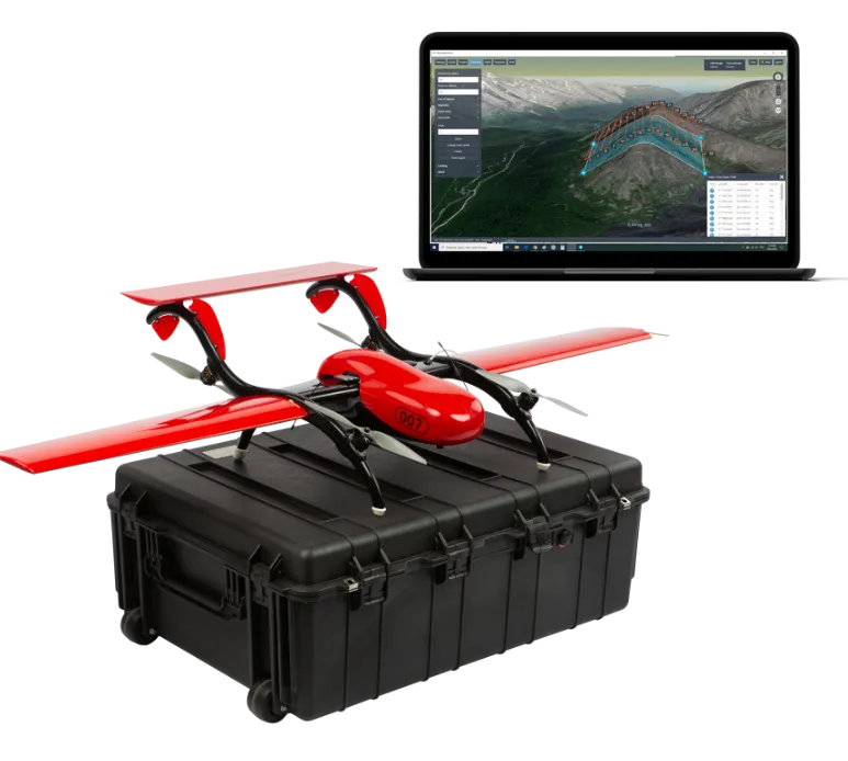
Sustainable UAV Solution for Multispectral Data Collection
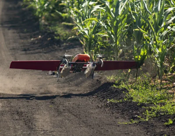
The FIXAR 007 drone is integrated with a multispectral camera designed to collect precise data for environmental and vegetation monitoring for agriculture, forestry and other industry needs.
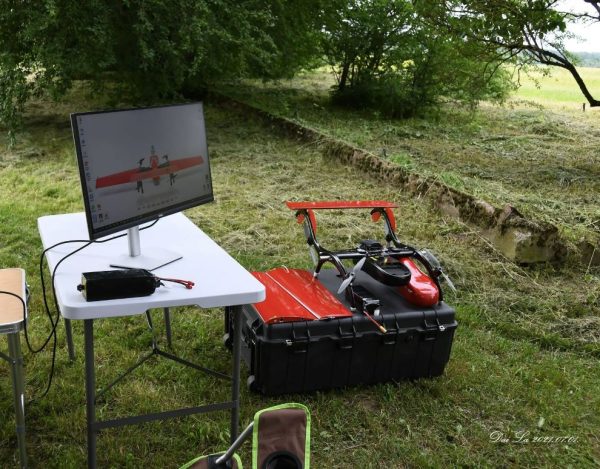
FIXAR xGroundControl Software allows users to collect data to make decisions allowing them to control the dosage and placement of plant protection products such as fertilizers and beneficial insects, as well analyze humidity and other relevant factors. This increases the yield and adds environmental benefit.
Learn moreMultispectral Imaging for Precision Agriculture and Forestry
Protection and Safety
Protect human and environmental health by reducing chemical exposure risks. You can also target only problem areas, leaving natural habitats intact.
Pest, Disease, and Crop Management
Control pests and weeds, and reduce the risk of disease. Easily manage plant populations and identify water stress and irrigation issues.
Targeted Controls
Target your controls and ensure accurate inventories. Detect tree density or nutritional deficiencies and apply a targeted solution using area-specific bio-production distribution.
Data-Driven
Get data instantly on soil fertility, plant populations, and many other important performance indicators using proprietary xGroundControl Software.
Precision Agriculture and Forestry Solution: FIXAR 007
Precision Agriculture Applications
The FIXAR 007 drones for agriculture and forestry are integrated with RedEdge-P to provide a complete solution for processing, storing, presenting, and analyzing multispectral data. This agriculture drone solution provides a cost-effective method of gathering crop health information without waiting for satellite passes or paying the high costs of manned-aircraft flights.
Forestry
Fixed-wing forestry drones can go where humans can’t. In forestry, they’re effective for information gathering, observation, and monitoring tree populations. They are also extremely applicable to reforestation efforts and planting initiatives.
FIXAR’s fixed-wing 007 model is also capable of drone laser scanning. Get maps, plant population statistics, and soil nutrient information, and identify areas with high and low water stress using laser scanning.
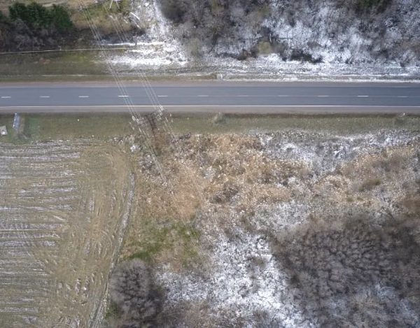
Multispectral imaging is most commonly used in agriculture and forestry, however, multispectral data application is stretching across industries and is becoming a more common solution for diverse environmental studies including water sources and quality assessments, natural disaster evaluation and monitoring, as well as tracking vegetation progress, etc.
Plug and Play Payload Modules Based on Real Job Tasks
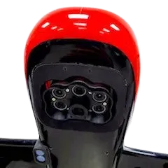
Multispectral camera MicaSense RedEdge-P
Multispectral images and subsequent processing in
photogrammetric tools (NDVI index calculation,
crop germination, etc.).
RedEdge-P features a high-resolution
panchromatic band for pan-sharpened
output resolutions of
2 cm / 0.8 in at 60 m / 200 ft.
Plug and Play Payload Modules Based on Real Job Tasks
Multispectral Imageryfor High Quality Yield
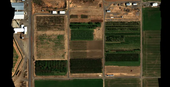
Orthomosaics
RedEdge-MX features global shutters for distortion-free images, including narrowband red, green, and blue bands for RGB color images that when processed are aligned to all visible and non-visible bands and vegetation indices.
Images: courtesy of MicaSense
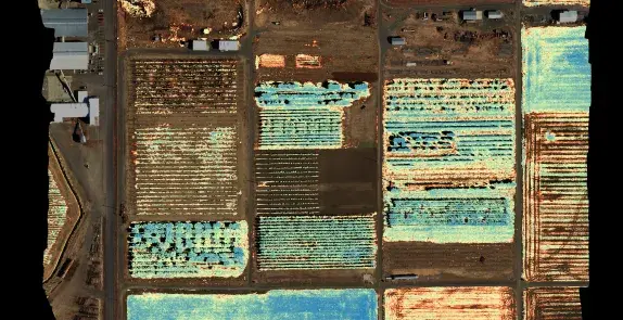
Normalized Difference Vegetation Index Map
NDVI Layer: This commonly known index compares the reflectance of the red band with that of the near-infrared band.
Images: courtesy of MicaSense
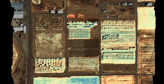
Normalized Difference Red Edge Map
NDRE is an index that can only be formulated when the Red edge band is available in a sensor. It is sensitive to chlorophyll content in leaves (how green a leaf appears), variability in leaf area, and soil background effects.
Images: courtesy of MicaSense
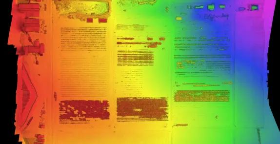
Digital Surface Model (DSM)
A DSM is an astonishingly advantageous tool in any agronomist’s arsenal, primarily because of its use in evaluating surface properties and water flow.
Images: courtesy of MicaSense
Explore Other Solutions
FIXAR drones are paired with proprietary software operating systems and controls to deliver all-in-one elegant UAV solutions, revolutionizing how technology is being used in various industries worldwide, including agriculture, oil & gas, construction & civil engineering, mining, surveying, photogrammetry, cartography, and more.

