Photogrammetry vs LiDAR – which one you need?
There is a broad range of sensors and solutions to equip the drone with and carry out different aerial tasks. That raises a question on what sensor or payload is the most suitable, considering the task and desired outcome. This can become a frustrating choice as the solutions significantly vary in terms of the price, output and integration options.
This time we are looking at two options that are often looked at and compared within surveying and mapping, construction, infrastructure and utilities sectors – photogrammetry and LiDAR.
What is Photogrammetry?
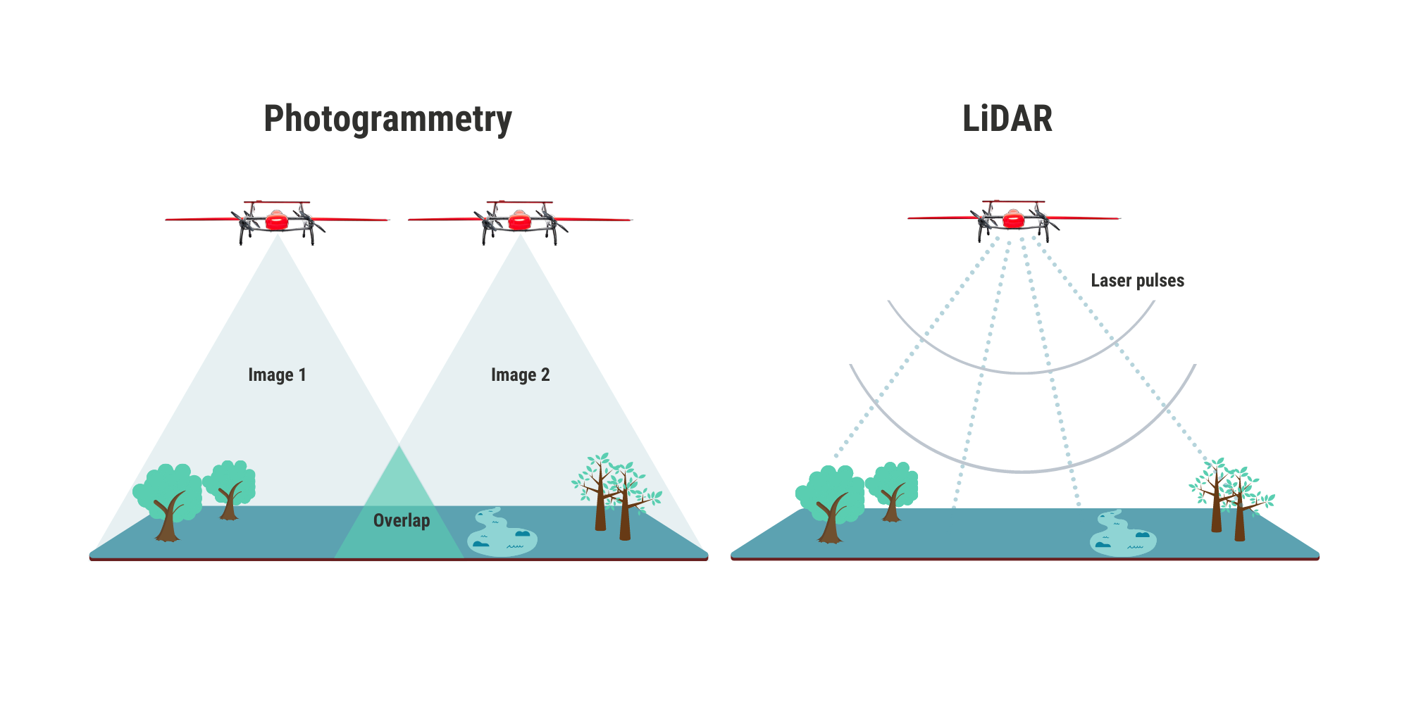
Photogrammetry technology gathers the measurements and data of an object by analyzing the change in position from high-resolution photographs. The main outputs of photogrammetric surveys are raw images, orthophoto maps, digital surface models, 3D models.
What is LiDAR?
LiDAR stands for Light Detection and Ranging (also Laser imaging, Detection, and Ranging), and this technology is based on laser beams or pulses. The sensor releases a laser pulse and measures the time it takes for the laser pulse to bounce back. The main data outputs are a 3D point clouds and 3D terrain digital maps.
Data Output Examples
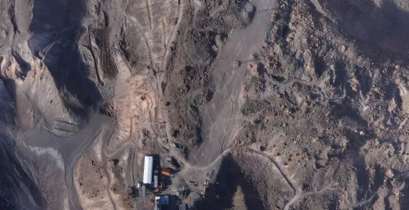
Photogrammetry: Orthomosaics map of Mount Elbrus
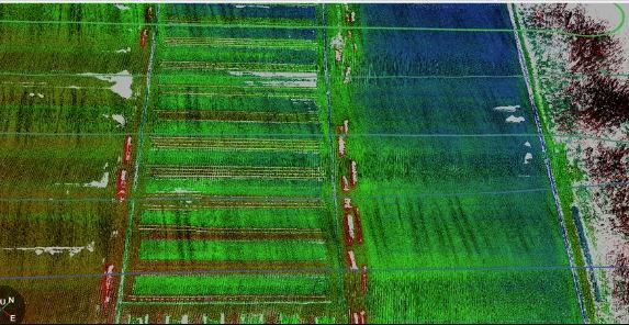
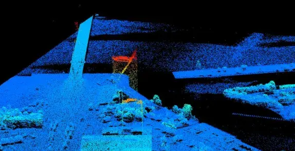
LiDAR: point cloud of a peat bog
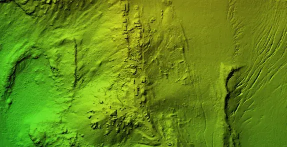
Photogrammetry: Digital Elevation Models (DSM/DTM) – Elevation model of the terrain of one of the slopes of Mount Elbrus.
LiDAR: 3D elevation point cloud of the city view
Data courtesy of The Latvian Geospatial Information Agency
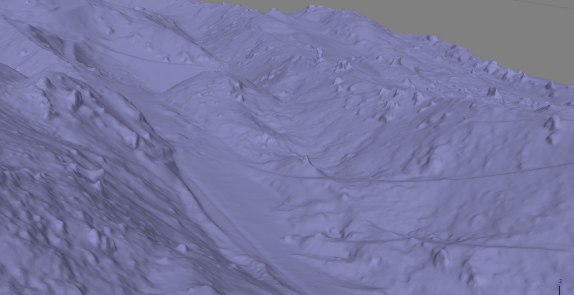
Photogrammetry: 3D Tin model of a mountainous area
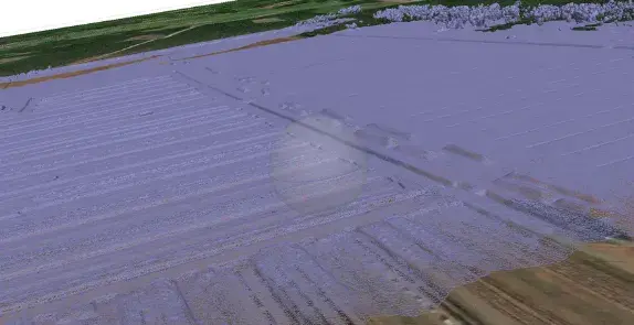
LiDAR: Initial LiDAR terrain model over a digital map
Photogrammetry: Orthomosaics map of Mount Elbrus
LiDAR: point cloud of a peat bog
Photogrammetry: Digital Elevation Models (DSM/DTM) – Elevation model of the terrain of one of the slopes of Mount Elbrus.
LiDAR: 3D elevation point cloud of the city view
Data courtesy of The Latvian Geospatial Information Agency
Photogrammetry: 3D Tin model of a mountainous area
LiDAR: Initial LiDAR terrain model over a digital map
Photogrammetry and LiDAR both are impressive technologies, but each has its own advantages for specific applications and conditions. In many cases, these technologies can be complementary to each other and enable to deliver even more data. As the technology is getting more accessible and affordable the operators may choose to simultaneously capture both – photos and laser scans – so that both data sets complement each other.
Often LiDAR is emphasized as a method with higher accuracy, yet both methods can deliver accurate maps. LiDAR accuracy is ensured by intensity of the light pulses released; higher number of the pulses will bring more precise data as point density will be greater. Meanwhile, photogrammetry data accuracy depends on aspects such as camera resolution and settings, flight altitude, ground sample size, but 1cm accuracy is achievable and, in many cases, this satisfies precision requirements. Yet, if we look at digital terrain mapping for areas with vegetation, then LiDAR will be a more precise tool, as laser pulses can penetrate between leaves and brunches.
|
|
|
|
|---|---|---|
| Price* Payload + UAV |
18 000 – 28 000 EUR 20 000 – 30 000 USD |
70 000 – 265 000 EUR 80 000 – 300 000 USD |
| Most suitable for tasks | Visual assessment Open area mapping (fields, mines, quarry’s etc.) Construction object mapping |
Mapping terrain under canopy and no-to-low texture Surveying narrow structures (power lines, towers, bridges etc.) |
| Advantages | Cost-efficient High horizontal accuracy |
High vertical accuracy Operational in poor light and dark |
| Limitations | Poor weather conditions affect image capture and quality Difficulty matching points between images with uniform textured surfaces (sand, water, ice etc.) Requires light |
Costly Higher weight and power consumption Limited horizontal accuracy |
So, how to choose the right technology for your task?
Photogrammetry will serve excellent for tasks that require cost-efficient visual assessments, commonly required in construction, asset management, agriculture, etc. Meanwhile, LiDAR will be a suitable choice for surveying narrow structures such as power lines, towers, areas with vegetation or low texture, as well as for tasks in poor lighting conditions and even for night missions.
Currently, LiDAR is a more expensive solution, approximately 4 to 10x more expensive for the setup of the UAV and the sensor depending on the setup choice. Often photogrammetry can deliver sufficient results at a significantly lower cost, therefore – evaluate conditions and mission goals before making the final choice.
Get in touch with us to learn more about payload options for your needs.