FIXAR
007 NG
Cost-Effective Drone Solutionfor Commercial Operations
FIXAR 007 NG is a fully autonomous, VTOL (vertical take-off and landing) fixed-wing drone designed to meet the needs of drone mapping and inspections professionals, aerial imaging, precision agriculture, oil and gas, surveillance and monitoring, and more.
The low-maintenance, easy-to-use drone can be set up in less than 5 minutes, and it can take off and land vertically with an accuracy field of 1 meter. The FIXAR 007 NG UAV for mapping and UAV surveying is an excellent tool for stress-free missions: they do not require any launch catapult or landing pad preparations.
See FIXAR 007 NG
in Action
See FIXAR 007 NG
in Action
FullyAutonomous
Vertical take-off and landing on any hard surface with one-meter radius accuracy
Watch videoOperates even in geomagnetic anomalies
Autonomous operation with proprietary FIXAR™ Autopilot
Fixed-Angle-Rotors: Absence of complicated mechanisms, No "dead" weight
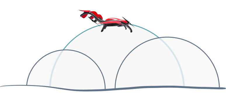
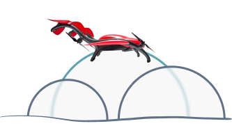
Long flight distance - up to 60 km (37.3 mi)
Why FIXAR
Reliable
Easy-to-use
Cost-effective
VersatileAll-in-One Solution
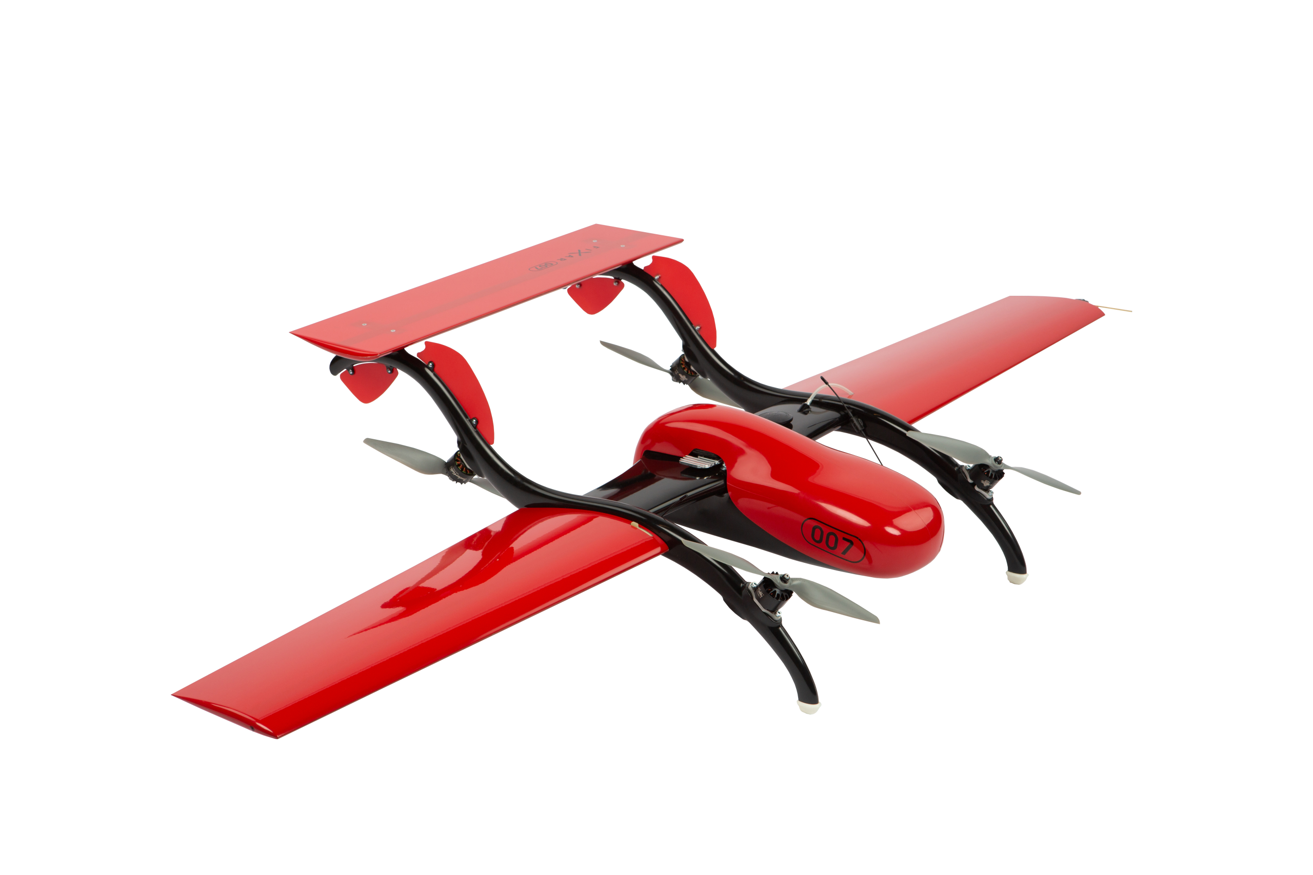
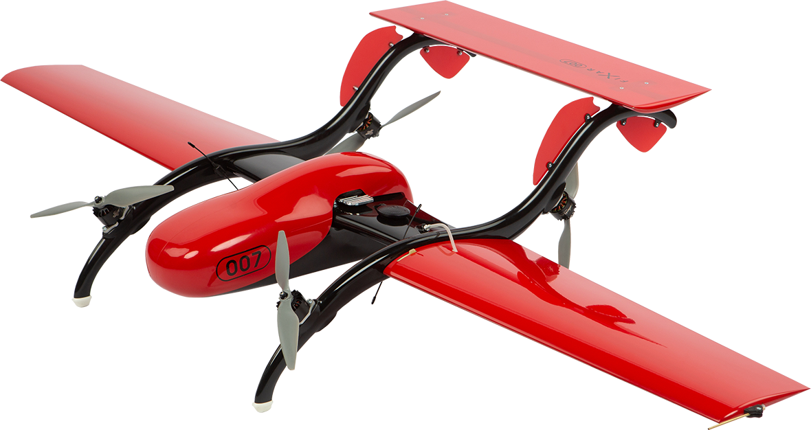
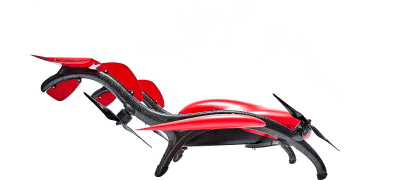
FIXAR 007 NG Aircraft
The FIXAR 007 NG’s patented hybrid design combines the take-off and landing maneuverability of multirotor drones with the increased payload capacity and endurance of fixed-wing UAVs.
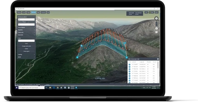
FIXAR xGround Control Software
The closed-source software allows you to build and edit a fixed-wing drone flight mission and monitor missions in real-time using 3D visualization.
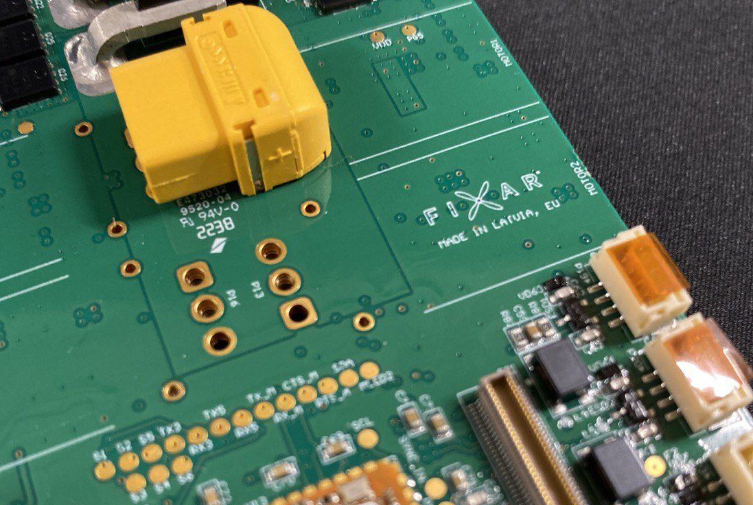
FIXAR Autopilot
The proprietary autopilot software provides a completely autonomous drone flight, including take-off and landing. It is also protected against confidential data breaches.
Single Dronefor Multiple Tasks
FIXAR 007 NG is a versatile drone that can be customized to provide technology-based solutions in a wide range of industries.
The VTOL drone can be equipped with a variety of sensors and can accommodate multiple payloads at once to accomplish your mission objectives in fewer flights. FIXAR 007 NG UAV features a convenient and flexible design of the payload compartment, which allows for integration with any third-party sensors such as RGB or multispectral cameras, hyperspectral sensors, LiDAR scanners, night vision cameras, and more.
The FIXAR 007 NG model features a high payload capacity of 2 kg (4.4 lbs), which allows for the installation of various sensors, so you can capture more data in fewer flights. The payload capacity is such that it even allows for a combination of RGB and multispectral camera use, which guarantees results with greater accuracy, precision, and cost-efficiency, all at a much finer resolution over increasingly large spatial scales, particularly when compared to other means of monitoring, such as foot surveys or manned aircrafts.
Every FIXAR 007 NG UAV is equipped with a BlackBox module, which is an extended feature that allows the system to record complete and detailed information of onboard flight activities and parameters. The drone BlackBox is a valuable and practical back-up system for the collected data by the payload, as the metadata of the mission can be exported using LogExport software with no data loss.
Comparison to other Productson the Market
|
|

|

|

|
|---|---|---|---|
| Models | FIXAR 007 NG | DJI Matrice, The Intel Falco 8+ | SenseFly eBee X, Delair UX11 |
| Flight distance | 60 km (37.2 mi) | ~10 km (6.2 mi) | 60 km (37.2 mi) |
| Payload | 2 kg (4.4 lbs) | 1.0-1.5 kg (2.2-3.3 lbs) | 0.5-1.0 kg (1.1-2.2 lbs) |
| Cost of delivery1 parcel to 10 km (6.2 mi) | € 23 -90% vs copters -60% vs planes |
€ 182 | € 57 |
| Cost of aerial mapping 6 000 ha at 5 cm/px(14 826 ac at 2 in/px) |
€ 4 206 -60% vs copters -20% vs planes |
€ 10 938 | € 5 144 |
| Cost of linear mapping 12 000 ha at 5 cm/px(29 652 ac at 2 in/px) |
€ 2 804-60% vs copters-20% vs planes | € 6 563 | € 3 429 |

- Small survey areas due to limited flying time
- Limited payload capabilities
- Less stability in wind
- Lower flight speed

- Runway or launcher needed for take-off and landing
- Unable to maintain fixes position (hover)
- Can fly only horizontally (forward)
- Difficult to land, more space needed
What Our Customers Say

Technical Specifications
*** ”Arctic” battery modification required
** Subject to weather conditions, altitude of flight, terrain
IndustrialApplications for UAV
FIXAR professional fixed-wing drones are paired with proprietary xGroundControl Software to deliver an elegant all-in-one UAV solution that is revolutionizing how technology is being used in various industries worldwide.
Would you like to learn how our professional drones use technology and data to leverage solutions that can improve your business performance? – Ask us now! We will be happy to answer your questions and put together a custom solution for your tasks.
Aerial Photography
- RGB cameras
- GNSS receiver
- Orthomosaics
- 3D models
- Point clouds
- Digital elevation models (DSM/DTM)
- Tiled models
Multispectral imaging
- Multispectral camera RedEdge-P
- Orthomosaics RGB/NDVI/CIR
- Vegetation index maps
- False-color band combinations
- Point clouds
- Digital elevation model (DSM)
Real-Time Video Monitoring
- Tarot Peeper 10x Optical Zoom
- Video Transmission System
- Eagle Eye-10IE 10X EO/IR Dual Sensor
- Sky Eye-I 1080P 10X Zoom
- Autonomous inspection rounds
- Consistent & persistent asset monitoring
- Remote operations
- Secure communications
Last-Mile Delivery
- Customized cargo box
- Container for document transportation
- Medicine case
- Faster and cheaper fulfillment
- Lower shipping and administration costs
- Last-mile connectivity to remote locations
- Environment-friendly
LiDAR Scanning
- YellowScan Mapper+OEM
- TOPODRONE LiDAR AVIA
- TOPODRONE LiDAR ULTRA
- Georeferenced LiDAR point cloud (.las or .laz)
- Digital Elevation/Surface/Terrain models (DEM/DSM/DTM
- LiDAR pointcloud colorisation using external orthophotos
- Underway: orthomosaics (in conjunction with RGB camera)
Maintenanceand Tech Support
Enjoy our full support, wherever you are
To deliver a complete end-to-end solution, any FIXAR package includes a complimentary two-day training experience that covers the essential information necessary to fly the FIXAR fixed-wing drone, including the online certification required to benefit from the warranty.
The extended 4 full-day training covers an introduction to FIXAR 007 NG UAV and its functionality, xGroundControl software training, xGroundControl software tips and tricks for advanced missions, work with PPK and other sensors, instructions on storage, batteries, and charging, safety rules, hands-on Demo flight, Q&A session with drone operators. Drop us a message to learn about training calendar slots.
FIXAR 007 NG packages include a warranty period of 12 months or 80 flights (take-off and landing cycle), from the date the product is received by the customer. During the warranty period, FIXAR provides free service and support (DDU dealer facilities) to repair damages or address malfunctions that are not the result of misuse, weather damage, or third-party use.