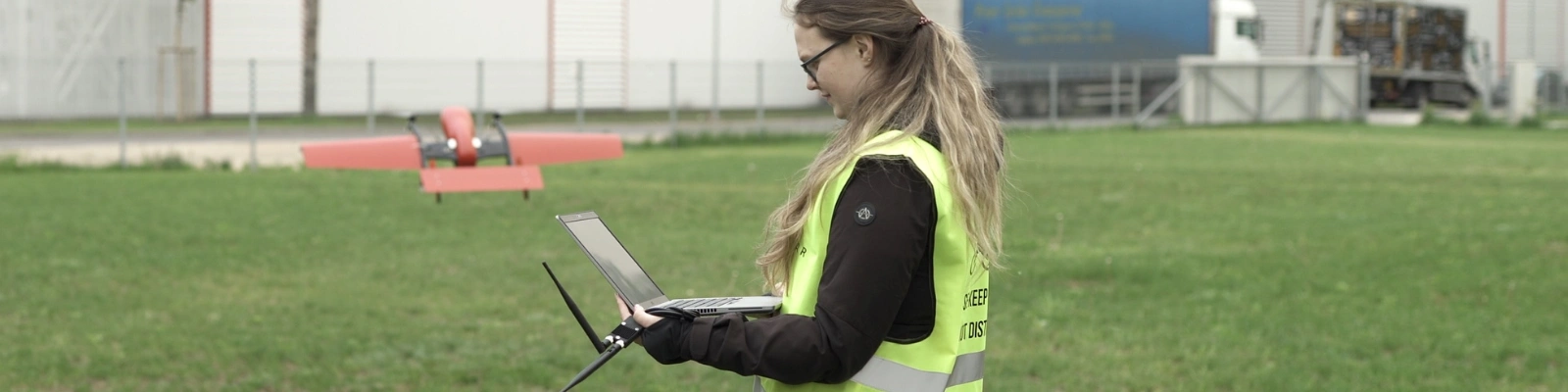
Drone Jobs 2022
We are now in the era of drones. Drone technology is better and more powerful than ever, and leaders and innovators in many fields are learning how to put to work and adapt commercial drones to their needs. These are good news for the growth and development of the efficiency of the business. As the demand for uncrewed aerial vehicles and the vital information they can gather from above grows, so does the need for pilots and program managers who know how to use these tools to their full potential. Since drones are becoming more popular, there is bound to be an increase in job vacancies in the drone industry.
Drones are already used to map land, take photos and videos from the air, do precise farming, keep people safe, and more. Changes in legislation in the future could open up even more options, such as long-distance package and mail delivery. There are numerous possibilities, for example, insurance companies, mine owners, real estate firms, and utilities need surveying and inspections and many other tasks to be handled.
But what would a day in the life of a drone pilot be like? What skills should drone pilots and the people who assist them have? What does the process of getting a license looks like in different countries? A person who wants to be a pilot can get closer to a rewarding job in a field with a bright future by finding the answers to these questions.
Where Do Drone Jobs Rise?
The United States is home to 41% of open vacancies in drone-related jobs. Then is Germany with 15% followed by India and Australia with 5% each. The United States is the clear leader in the drone employment market and drone pilot demand, with almost three times more open vacancies than any other country. The US military is the largest employer, but with also many other jobs available in the commercial and government sectors. The USA, UK, Canada, Australia, Japan, China, and South Africa are countries with a large employment market in drone areas both for commercial and personal purposes and are in high demand. You can be a commercial photographer, a real estate agent, an agriculturalist, a law enforcement officer, etc.
5 High-Growth Areas for Professional Drone Pilots
The following sections illustrate some of the specialties in which drone operators have had great success. Here are some sectors you might want to research first if you’re thinking of becoming a professional pilot:
Mapping, surveying and modeling
As drone technology advances, more mapping professionals recognize the value of 3D modeling. Drone technology has had a significant impact on the surveying and mapping industries. Aerial photographers can capture scenery from unique angles that expensive and highly specialized equipment cannot. And users have grown accustomed to the experience of exploring lifelike images with a few mouse clicks, thanks to advanced technologies.
Modeling and mapping with drones require two different skill sets. UAV pilots use drone mapping to capture detailed aerial images to create an accurate map. They, however, bear no resemblance to their folded, paper forefathers. Drone mapping images provide a detailed overview of the terrain, including artificial structures and natural features. Furthermore, drone-captured aerial photos give viewers a sense of topographical depth and size. These maps are valuable for professionals when combined with other data, such as agricultural, thermal, or industrial information.
Thermography
Thermal imaging employed on drones has a wide range of uses. You can work in various fields, from performing roof inspections to assisting emergency personnel. the usage of drones has altered how these experts perceive their work. The most significant users of thermal drone technology are members of the police and fire departments. Law enforcement officials can employ drones for various tasks, but they typically use them to track down suspects at night or in other low-light conditions.
Drones are frequently used by those who perform search and rescue. The technique significantly reduces search time, lowers crew risk, and improves the possibility of a successful recovery. In actuality, search and rescue specialists now heavily rely on it. Drones with thermal imaging capabilities benefit from this because body heat is noticeable among greenery and plant life. In some circumstances, this makes it simple for rescue workers to use thermal drones to locate victims.
Photography and video for real estate
Real estate development projects often utilize drone technology to document the development stages of the project, especially the large-scale construction sites with complex objects. This allows to monitor the progress of the project and timely identify risks to mitigate them in a fast manner.
Real estate professionals also use drone technology to produce excellent complex and modern marketing materials. It affects how agents find creative ways to interact with clients and makes sellers stand out in an overcrowded market. Using drone technology, agents and sellers may showcase homes with stunning photographs, engaging movies, and other digital assets.
For all parties involved, drone technology offers more significant and effective results. Among other things, this entails the ability to raise sale prices. Additionally, it gives real estate professionals access to alluring aerial images that they can utilize to persuade potential customers to make a purchase. Stock photos are still helpful in the field, but they force prospective buyers to piece together images to gain a sense of the appearance of a home. But with drone photography, prospective buyers can see more clearly how features are arranged on the house.
Inspections
Professional drone operators, for instance, can assist business owners at industrial plants using infrared imaging, and carry out infrastructure monitoring tasks in oil & gas, and energy sectors. Inspection tasks are applied also to utility networks, environmental assessment and agriculture fields. Drone operators can also employ a variety of 3D modeling software packages to record and recreate structural imagery for clients.
It’s crucial to demonstrate how cost-effective the usage of drones can be to one’s business. For instance, if a potential problem had gone unnoticed the results would be very costly and even with unimaginable consequences and even loss of life as the structural integrity of a building could just collapse.
Entertainment – television and movies
Most customers nowadays are aware that Hollywood producers employ drones in the production of movies. In reality, since the United States government allowed drones for commercial usage in 2014, this has become a common routine. Filmmakers were quick to see the possibilities and potential of drones even before it was approved in the United States for their commercial use. In 2015, filmmakers developed a blended sequence in Jurassic World where a piloted drone caught a crowd of people reacting to a dinosaur attack.
In Hollywood, drone cinematography is becoming a practical tool utilized in conjunction with conventional tools like dollies and jibs (the jib is used to lend motion and height perspective to pictures, while the doll is typically employed for shots at eye level). They are currently unusable for several applications due to their short battery life and restricted height of flight.

Drone careers in the future
Careers in drone operation are virtually limitless. Evolving laws may soon allow for flying practices that are currently restricted or only permitted by waiver, such as BVLOS operation and swarming (one operator controlling many drones). Because drone technology is sufficiently advanced, these changes could occur quickly.
Jobs such as long-distance package delivery and roles in fields already heavily invested in drones could soon become prime opportunities for drone operators and pilots. There are numerous reasons to start learning the trade now.